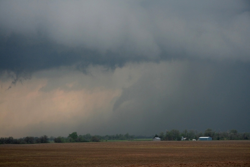
Login « Sidebar
Gallery » USA 2007 » 5th May 2007 » USA_2007_Day_8_070.jpg


USA_2007_Day_8_070.jpg
A line of storms developed ahead of the dryline.  This was one near Larned, Ks. Another line of supercells developed to our west so we gave chase.  Looking W from Trousdale, KS. We intercepted the cell near Fellsburg, KS.  It had some nice structure. The cell wrapped up a bit near Trousdale, Ks but was suffering a little from lack of instability.
A closer view of the wall cloud from near Trousdale, Ks. USA_2007_Day_8_070.jpg USA_2007_Day_8_078.jpg The contrast was bad and the light was very low as it was after sunset.  Looking NW towards Macksville, Ks.
Stove pipe tornado lit up by lightning on dusk near Macksville, Ks.  Note:  Video capture only. Another flash lit up the tornado.  You can see the debris cloud around the base of the tornado.  Near Macksville, KS.

We dropped S to the next supercell in the line which was tornado warned and we saw this funnel cloud appear from behind rain curtains WNW of Pratt, Ks.

Date: 05/06/07


Actions

View Slideshow (Fullscreen)

5th May 2007

1. A line of... ... 3. We... 4. The cell... 5. A closer... 6. USA_2007_Da... 7. USA_2007_Da... 8. The... 9. Stove pipe ... 10. Another...

Random Image

IMG_0604

IMG_0604

Date: 11/08/10 Views: 20191

Powered by Gallery v2.3